
Tropical Storm Elsa To Bring Hazardous Weather to Hudson Valley
Tropical Storm Elsa has pounded New Jersey and New York City and is making its way to the Hudson Valley. Multiple weather warnings have been issued for the region.

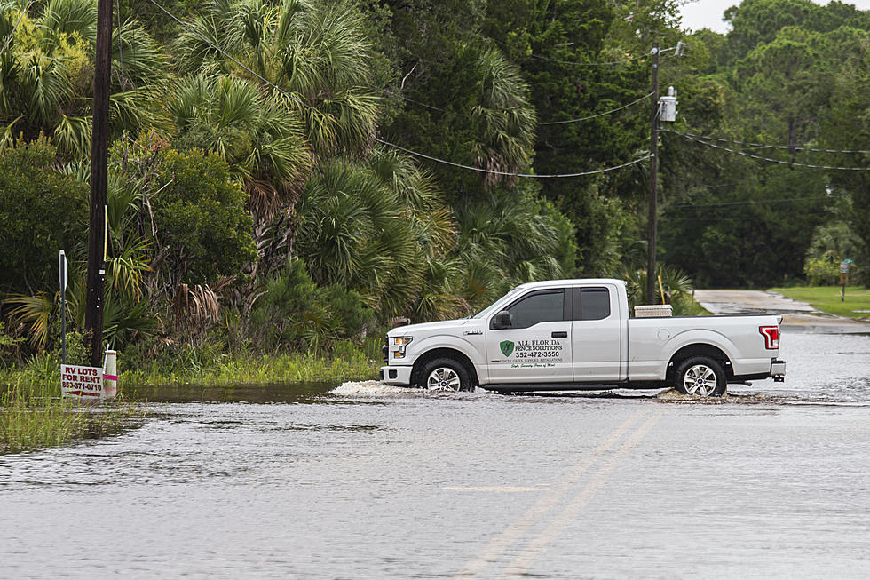
Tropical Storm Elsa has slammed the Tri-State. It reached New Jersey last night and is moving fast toward New York City this morning. The Hudson Valley is at risk for flooding today.
The National Weather Service has issued a Flash Flood Watch until noon for Orange and Putnam counties.
"Heavy rainfall associated with tropical system Elsa will move into portions of the Tri-State area this morning, with periods of heavy rainfall possible through midday. Although heavy rainfall will be possible this afternoon, the greater chances for this will begin tonight. Total rainfall from this afternoon through Friday is expected to range mostly 2 to 4 inches, with locally higher amounts possible," the National Weather Service stated in the alert.
For all the news that the Hudson Valley is sharing make sure to follow Hudson Valley Post on Facebook, download the Hudson Valley Post Mobile App and sign up for the Hudson Valley Post Newsletter.
A Flash Flood Watch is in effect in Ulster and Dutchess Counties until 4 p.m. on Friday.
Rain is expected this morning with periods of heavy rainfall into the early afternoon. Total rainfall through today is expected to range from 1 to 3 inches, with locally higher amounts possible.
Heavy rain may cause some smaller rivers and streams to quickly rise out of their banks. There's also the potential for flash flooding in areas of poor drainage, officials say.
In Sullivan County, a Flood Advisory is in effect until 9:30 a.m. while a Flash Flood Watch lasts until 11 a.m.
"Some locations that will experience flooding include Liberty, Bethel, Neversink, South Fallsburg, Swan Lake, Harris, White Sulphur Springs, Mongaup Valley, White Lake, Smallwood, Hurleyville, Parksville, Loch Sheldrake, Willowemoc, Grahamsville, Lava, Tusten, Ferndale, Briscoe and Bradley. Persistent rainfall over the past couple of days has made the area very sensitive to more rain. Much of any new rain is likely to run off quickly, causing ponding of water and minor flooding of small streams and creeks," the National Weather Service writes about Sullivan County.
A Flood Advisory is in effect until 8:30 a.m. in Rockland and Westchester counties while a Flash Flood Watch is in effect until noon.
The storm is expected to head back out to sea by tonight.
Keep Scrolling:
LOOK: The most expensive weather and climate disasters in recent decades
Gallery Credit: KATELYN LEBOFF
TIPS: Here's how you can prepare for power outages
KEEP LOOKING: See what 50 company logos looked like then and now
Gypsy Moth 'Accidentally' Released Causing 'Nightmares' in New York
More From 94.3 Lite FM